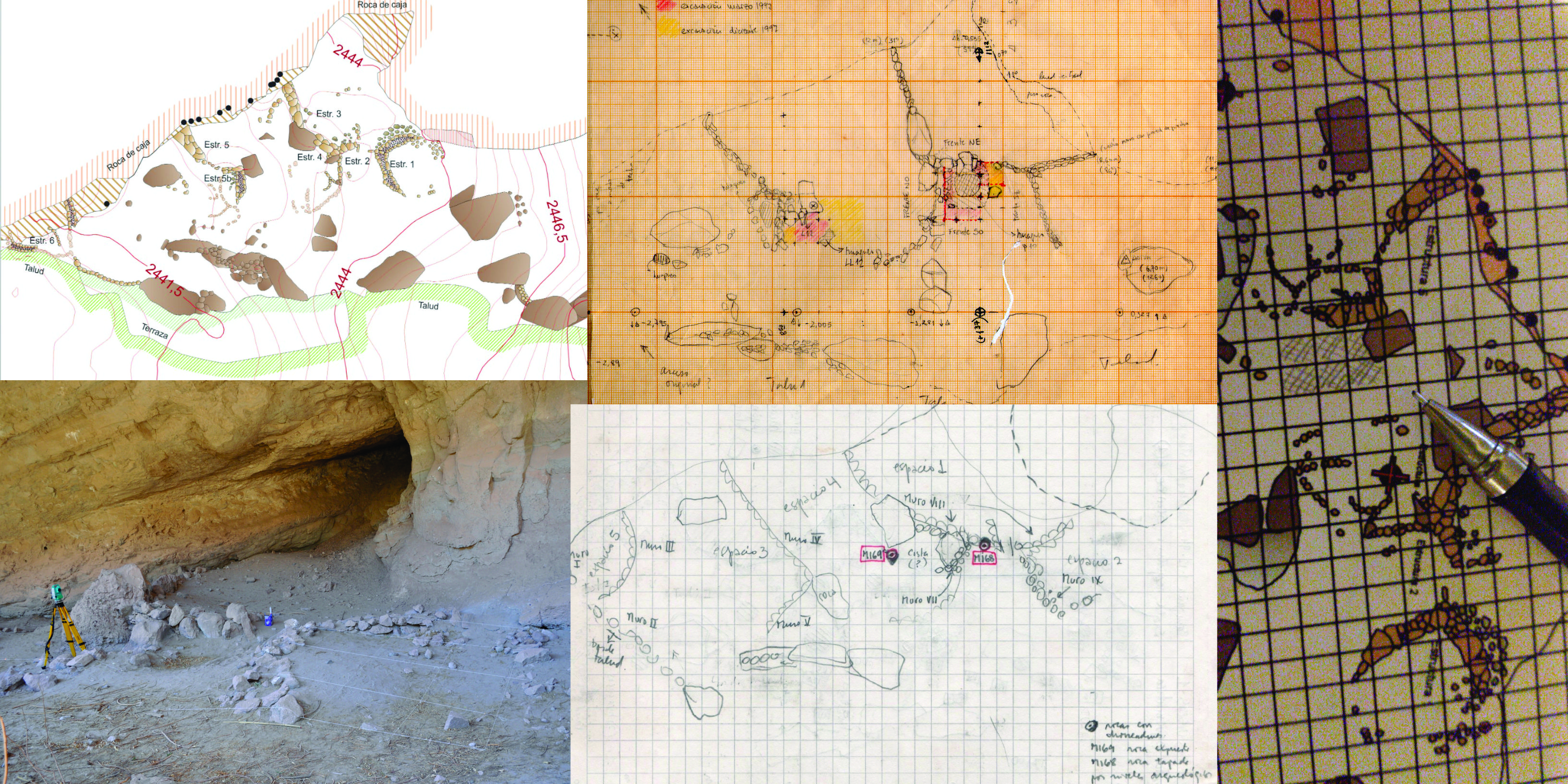
Back to Los Viscos: Revamping mapping and cartography of a rockshelter site with inner architecture in the western Catamarca high valleys.
Main Article Content
Abstract
Los Viscos is a complex archaeological site in a large rockshelter in Catamarca, Argentina. It has been under study since the 1990s. In 2017, following new research perspectives and in light of the availability of more accurate measurement tools than before, a new archaeological mapping of Los Viscos was started to work as a descriptive and interpretive basis. This paper aims at historicizing the mapping of this particular site through the last 25 years and analyzing its implications to local research. Based on this experience, we reflect about the descriptive and interpretive processes in archaeological mapping generally. This task should consider not only the technical aspects of the survey, but also the previous cartography available and the measurement, recording and representation tools. The process deserves our attention and epistemological surveillance as an exercise of decision-making and negotiations, inasmuch as the history of every site and its narratives are partly based on its cartographic representation, be they explicit or not.
Downloads
Article Details

This work is licensed under a Creative Commons Attribution-ShareAlike 4.0 International License.
COPYLEFT
This work is licensed under a Creative Commons Attribution-Share Alike 4.0 International License.
COPYRIGTH
The copyright and copyrights of the articles are held by the authors themselves.
This will be indicated in each article, as well as the Copyleft license described above.
How to Cite
References
Bar-Yosef, O. y Goren, N.
1973 Natufian remains in Hayonim Cave. Paléorient 1 (1): 49-68
García, M. y Sepúlveda, M.
2011 Contextos vegetales de aleros con pinturas (precordillera de Arica, norte de Chile). Revista Estudios Atacameños: Arqueología y Antropología Surandinas (41): 97–118
González Aguilera, D.; Muñoz-Nieto, A.; Gómez-Lahoz, J.; Herrero-Pascual, J. y Gutierrez-Alonso, G.
2009 3D Digital Surveying and Modelling of Cave Geometry: Application to Paleolithic Rock Art. Sensors 9: 1108-1127.
Korstanje, M. A.
2010 El IAM en los Valles altos del oeste catamarqueño. Rastros en el Camino. Trayectos e Identidades de una Institución. (ed. por P. Arenas, C. Taboada y C. Aschero), pp. 295-302. EDUNT (UNT), Tucumán.
Lyman, R. L.
1987 Zooarchaeology and taphonomy: A general consideration. Journal of Ethnobiology 7 (1): 93-117
Lyman, R. L.
1994 Vertebrate Taphonomy. Cambridge University Press, Cambridge.
Mattes, J.
2015 Underground fieldwork – A cultural and social history of cave cartography and surveying instruments in the 19th and at the beginning of the 20th century. International Journal of Speleology 44 (3): 251-266.
Mondini, M., y Arias, M. F.
2019 Interacciones entre humanos y animales en los Valles Altos de Catamarca desde el Formativo hasta tiempos recientes: El caso del Alero Los Viscos. Libro de Resumenes del V Congreso Nacional de Zooarqueología Argentina pp. 158-159 Universidad Nacional de Catamarca. Secretaría de Extensión Universitaria, Catamarca.
Torre, I; , Arroyo, A; Proffitt, T; Ramos, C. M. y Theodoropoulou, A.
2015 Archaeological fieldwork techniques in Stone Age sites. Some case studies
Trimmis, K. P.
2018 Paperless mapping and cave archaeology: A review on the application of DistoX survey method in archaeological cave sites. Journal of Archaeological Science: Reports 18: 399-407.


